Tuesday, April 30, 2013

April 30 continued

On this radar image you can see a squall line moving in associated with that cold airmass. Also there is a lightening strikes map to show the thunderstorms in the squall line.


April 30

Today started out a little damp, but became very nice for the most part. Not too clear out but the clouds have had many breaks in them. Many cumulus humilis clouds, now we are seeing alto stratus, possibly congestus clouds, and cirrus clouds. This indicates instability and moisture in the air. I expect we can see rain tonight or tomorrow.


Temperature: 68°F
Dew point: 40°F
Humidity: 37%
Pressure: 1007.5 mb
Wind: W 7 mph

 The surface map for today indicates the start of the (last) cold snap. We have a low pressure system in our region in which we were mainly in the southern portion of, which is explains the warm weather, due to the warm air rotating counter clockwise around that low system from the south. But now as that system dies out, the jetstream will change, bringing a cold continental polar air mass south over the next few days, possibly bringing snow or just colder rain.
 The dip over Saskatchewan shows that airmass moving south.

The moisture over the mid states will follow the jetstream up into our area, dumping that moisture on us. You can also see the mid latitude cyclone forming from the current low pretty neat.

Monday, April 29, 2013

April 29

It rained this morning, however by 9am it was overcast and no longer raining. As of now the clouds are breaking up and it is rather nice outside.

 
Temperature: 67°F
Dew point: 56°F
Humidity: 69%
Pressure: 1007.2 mb
Wind: 0 mph

 There is a high pressure system near Wisconsin giving us clear weather. The pressure is dropping though, possibly from that low to the west.

 Plenty of moisture developing to the west. will likely give us more moisture tonight and through the week.
The kink we talked about yesterday moved up to the north. The jetstream seems pretty docile over our area.

Sunday, April 28, 2013

April 28


My nephew is being born today! its a nice day for it that's for sure. Not as nice as yesterday, but still warm and bright.

Temperature: 67°F
Dew Point: 45°F
Humidity: 45%
Pressure: 1010.6 mb (dropping)
Wind: SW 9 mph

 Well, here is the surface map, you can see that low pressure system over minnesota making its way to us in Wisconsin, there is that kink in the jetstream you can see in the image below, we can expect a dip in temperatures, and plenty of precipitation tonight and next week as the cold airmass from the north converges with the warm southern airmass that is associated with that high pressure system near Texas.  Also, you can see that distinct comma shape in the system over indiana, a mid latitude cyclone is forming that will certainly bring rain to the east coast.

Again you can see that mass of moisture rotating around the low, forming a comma shape, cyclone. Pretty neat! Also, the moisture above Minnesota will make its way to us this week.

Saturday, April 27, 2013

April 27

Yesterday was phenomenal, great weather, I went on a trip to the Ice Age Trail with Geography 304 so I forgot to post the weather. There was a light rain in the morning as predicted.
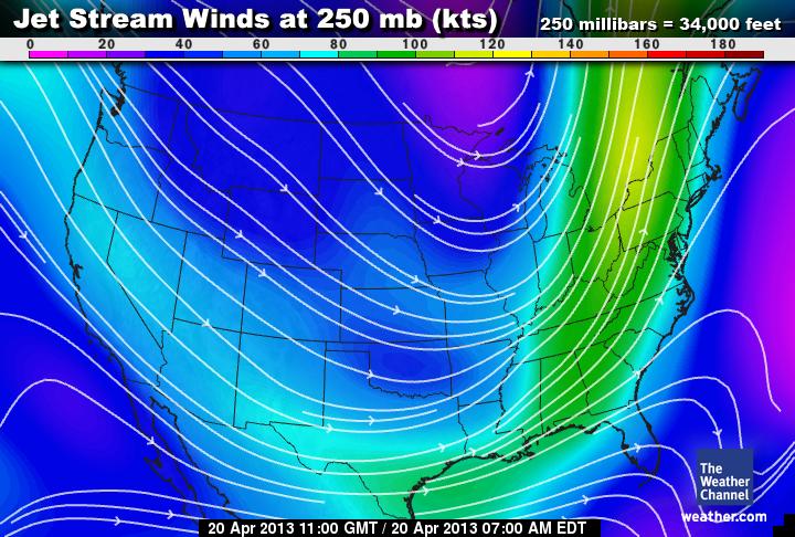
 you can see the juxtaposition of the nice sky and the storm cloud. This was caused by that dip in the jetstream we talked about last post.

This is a panorama of the rain cloud (the black on top is from the camera)

Today was another stunning day, some interesting clouds about, I am seeing some darker cumulus congestus clouds, altostratus, and cirrus clouds today.
Today's photo, as you can see, lots of different types of clouds, this is pointing to the west/south west. May be indicative of turbulent weather tomorrow night.

Temperature: 71°F (say what? I can dig it)
Dew point: 45°F
Humidity: 40%
Pressure: 1015.9mb (and dropping according to weatherbug)
Wind: W 7 mph
There are two low pressure domes to the north, the lower one is pushing warm air east, we are still feeling the effects of the high pressure system that has been prevalent yesterday. However starting tomorrow night that low pressure area will pass further east creating changing wind direction to come from the north and causing a drop in temperatures and precipitation next week.

 That circle in the middle under the dakotas is a high pressure system, it is causing a pressure ridge in our area, which explain the exceptionally nice weather we are having. Tomorrow night that will clear out and a lower pressure will result, causing rain and possibly snow.
There is a great deal of moisture to the south and west of Wisconsin. As the western moisture moves east,  it may dry up a little due to orographic lifting over the Rockies, the moisture to the south may move north.

Thursday, April 25, 2013

April 25

Today was nice again, and this time I didn't have to scrape ice off my car in the morning... yay!

Temperature: 47°F
Dewpoint: 27°F
Humidity: 48%
Wind: SSW 8mph
Pressure: 1022.4 mb

 The lovely afternoon sky from where I work. You can see the nice puffy cumulus clouds, rain is predicted for the evening thus these clouds may be a sign of instability in the atmosphere.
 Here you can see the surface map and how we are still being affected by the high pressure. However, in the upper atmosphere that low by the Great Lakes will give us some more precipitation tonight.

At the 500mb height of this surface map we can see a "blip" in the jetstream (circle 1), that will give us the rain this evening, by pushing cold air south. Circle 2 represents another kink or blip in the jetstream that will begin with pushing us into another high pressure ridge over the weekend, giving us nice weather, but the gap after it represents a low pressure system that will move in on Monday night giving us another storm for Tuesday.

Wednesday, April 24, 2013

April 24 Spring!

Today is very nice, finally we can get some spring weather.

Temperature: 49°F
Dewpoint: 25°F
Humidity: 40%
Wind: WSW 6mph
Pressure: 1014.6 mb

The low pressure system that affected us before has moved out of the area. As predicted yesterday, the high pressure system has developed to the west and south. the Southern high pressure system is pushing maritime tropical airmass to the north and is giving us a ridge which will bring warm temperatures and clear skies over the week and weekend.

There is a ridge of storms over the east coast going from Louisiana to Michigan from the previous system that moved in. Because of the warm air mass from the south, theres is also a ridge of thunderstorms on the east coast.


Awesome cumulus clouds, there were many cumulus humilis clouds today that indicate fair weather ahead!

Tuesday, April 23, 2013

April 23 continued

Cumulus humilis clouds in the west. Shows the breakup of that low pressure cloud cover from earlier.

April 23

Apparently it snowed outside last night, bummer.  At the moment it is dry but the ground is still wet. I expect more precipitation today.

Temperature: 32°F
Dewpoint: 31°F
Humidity: 100%
Pressure: 1017.7 mb
Wind: NNE 2 mph

Here you can see there is a low system over the great lakes, causing a lake effect snowfall in their area. As that low moves out of the area we should expect to see some warm winds coming into our area, a ridge in the jetstream will develop giving us warmer temperatures and clear skies as a high pressure system moves in.

Monday, April 22, 2013

April 22

Yesterday was fun... started with snow, which turned into rain.

Today we have a light rain, which was a bit heavier in the morning, but has since died down a bit.

Temperature: 38°F
Dewpoint: 37°F
Humidity: 100%
Wind: ENE 8mph
Pressure: 1020.6 mb

 Looks like there is a ridge of storms moving over Nebraska and Iowa that may make its way to us. With the cool northern airmass and the southern warm airmass, we can expect to see more precipitation over the next few days, we can also expect to see some nicer weather by thursday as the low pressure area moves to the east.

You can see the moisture over Nebraska, Iowa and Minnesota that will translate into precipitation for us over the start of this week.

Saturday, April 20, 2013

April 20 Sprinter

So I was at work today engaging in small talk with the customers and a lady said to me that Wisconsin has a new season: Sprinter - which is Spring and Winter. She said, when its nice out (like today) its Spring, and when its gross out (like thursday) its Winter. I thought it was hilarious.

Anyway, today is nice, we have beautiful clear blue skies and decent temperatures.

Temperature: 43°F
Dewpoint: 12°F
Humidity: 29%
Pressure: 1025.7 mb
Wind: NNW 4mph

 In today's surface map you can see the high pressure system that is giving us this nice weather. It may continue into tomorrow, but likely we will be affected by the Alberta clipper low pressure system forming in the west.
 The Alberta clipper will likely follow this jetstream pathway to our location, mixing again with warmer maritime air from the south and bringing a cold continental polar airmass with it, possibly creating cold temperatures rain, and hopefully not, snow.
Here you can see the moisture developing in the west. As well as the remnants of the previous system on the east coast.

Friday, April 19, 2013

April 19 may showers bring june flowers...

There was snow overnight into this morning, which tapered off into a light rain. My car was covered in snow, there was a strong wind when I went to clear it. Now the cloud cover is breaking with cirrus clouds and stratus cumulus clouds and blue sky.

Temperature: 30°F
Dewpoint: 24°F
Humidity: 81%
Wind: N 11 mph
Pressure: 999.6mb

 We have a low pressure system in our area, which accounts for the precipitation and snow we are experiencing. There is a continental polar airmass that has moved down, and is still pushing through the United States. The low system from colorado ahs combined with another system on the east coast, mixing with the maritime air from the northeast. That ridge of storms will continue to move east. We should expect cool temperatures as another cold airmass descends from the north.

That mass of moisture we've been looking at the past few days is now over Canada, but may affect us in the coming days as it rotates around the low pressure systems.

Thursday, April 18, 2013

April 18

It was raining this morning, overcast clouds.

Temperature: 33°F
Dewpoint: 33°F
Humidity: 100%
Pressure: 1007.0 mb
Wind: ENE 6mph

 The colorado low has progressed up into Illinois, creating large storms and precipitation, we may see 1-3" of snow today. There is a large dichotomy in the temperatures over the states now due to the large trough in the jetstream. The continental polar air mass will cause snow in our region, yet the warm front from the maritime tropical air mass will push up causing rain as well.


 Here you can see the large amount of moisture in the atmosphere as those two airmasses mix.
The purple area in the north west represents that trough, you can see why we have that distinct line of storms that runs parallel to the jetstream.

Wednesday, April 17, 2013

April 17

Today was mostly overcast, we had a really cool sky this morning around 7am, there were plenty of stratus undulatus clouds and cumulus clouds. We had a light rain for most of the day, which turned into a hail for a little bit also.


Temperature: 38°F
Dewpoint: 30°F
Humidity: 73%
Pressure: 1016.6 mb
Wind: E 11mph

 As you can see in these two images there is a lot of moisture in our area, due to an influx of warm maritime tropical air from the south east. There is a warm front circling a low over Kansas, mixing with the cold continental polar air from the northwest, that colorado low will continue to move east, giving us more precipitation for probably the next two days at least, but possibly even into the weekend, especially if those lows near Texas follow the jetstream as well.

Tuesday, April 16, 2013

April 16

We've got some awesome cumulus humulis clouds outside today, very pretty.

Temperature: 44°F
Dewpoint: 29°F
Humidity: 55%
Pressure: 1024.4 mb
Wind: 5mph NNW

 Here you can see we have a high pressure system over our area, which is being influenced by a colder air mass to the north. The colorado low to the west is forming nicely with a dry line creating fog and inclement weather in that area, which in turn will ride the jetstream to our location possibly in the next day or on Thursday. We may have some mixing with a maritime tropical airmass, creating a cyclone, but we'll see if something like that develops.

Here you can see that moisture forming near colorado, a orographic effect from the Rocky mountains.

Exercise 5 Maps

Here are the maps I created for Exercise 5: