Today was chilly, as of this time no precipitation. (yay)
Temperature: 39°F
Dewpoint: 28°F
Humidity: 64%
Pressure: 1016.7 mb
Wind: 5mph W
Here is a photo from this morning around 7am, you can see a slight red tint, which brings about the old folk saying that I grew up - "Red sky in morning, sailors take warning". I think we are seeing some instability in the atmosphere, especially with the cloud cover. We have some Stratus clouds, along with some altocirrus clouds.
Here we can see another continental polar air mass making its way down across the United states. The tip of the cold front is just approaching Wisconsin. The low to the west will make its way east, and its cold air will mix with the warm air coming from the southern tropical jetstream, creating precipitation for us, possibly light snow or rain.
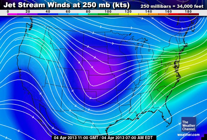
Here you can see a unisys 500 mb map. This height in mb is great to look at because it is not at the surface level, and not too high in the atmosphere that we can see patterns in weather. This picture combined with the jetstream image below, paints a clear picture of the weather patterns. We can see a distinct trough in the mid states Nebraska and Kansas. It almost looks like the low pressure system has moved a little east already, we may get precipitation tomorrow, however there is a possibility that the lower half of Wisconsin will be affected, and we may have cloud cover and colder temperatures instead.
Here is the water vapor map, you can see a possible cyclone developing by the gulf of mexico.


No comments:
Post a Comment